FRIENDS of ... 

SALTA

Through the Iruya riverbed
"An excursion on horseback from Iruya to Orán"
Nicolás Bello and Nora María Bello

Page 2

Written by Nico Bello in August 2003.

After noon, we resumed our journey on the playa of the Iruya (sandy riverbed), always guarded by the high walls of its slopes. We passed on our left the access to the San Juan valley and later the Agua Blanca hamlet, advancing over the river canyon with numerous cultivation terraces that climb the mountain and are currently in use. Beyond is Chañar, another hamlet, and a few kilometers further, Chaupi Higuera where we cooled off and loaded water from a crystalline brook.

We began to notice that the river, which at the exit of Iruya was no more than a trickle of water, had increased its flow to the point that at each crossing with our animals we began to wet our shoes, although by then the water reached only up to half of the legs of the horses.

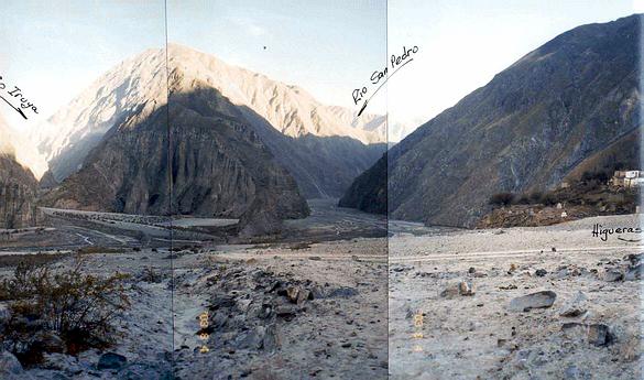
In the afternoon we could see the town of Higueras in the distance, over the stream of the same name and at the confluence of the Iruya and San Pedro rivers.

5-Higueras, junction of the rivers Iruya and San Pedro

This confluence of rivers is a great amphitheater of which the inhabitants of Higueras are the main spectators. It is worth watching from above. The imposing encounter of the named rivers surprises the traveler, as does the harsh and rough landscape of the surrounding mountains. The bright colors we saw in Iruya have been transforming, losing intensity, and diluting into innumerable shades of gray and brown.

From a distance we could see the chapel of Higuera, with the typical celestial light-blue roof that characterizes the churches and chapels of the area, located in the middle of the hamlet. Downhill and on a wide terrace, there is a badly maintained cemetery still in use. In the empty spaces left by the crowded set of houses, there were a few plantings of vegetables and alfalfa.

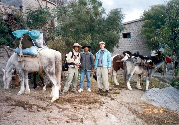
6-Nora María with our baquianos Martín and Miguel


HIGUERAS

The small town of Higuera is a hamlet nestled into the side of the mountain, its houses crowded together, giving rise to numerous passages used by the locals and the countless kids who attend school. The school is a building that works also as a shelter for the 120 children of inaccessible places in the surrounding area that attend its classrooms. We were well received by the faculty and its kind director, who invited us to eat delicious empanadas criollas (local pasties) accompanied by a hearty soup that revived our spirits.

Higuera is currently a town threatened by the volcan (peculiar mud flood) of the Higuera stream, which with its summer floods moves and transports huge amounts of mud, thus impacting the lives of its inhabitants by conditioning mobility.

We had traveled just over 16 km from Iruya to 1932 meters above sea level, having descended a total of 818 meters, representing a slope of 5.1%, a very significant value for a mountain river. May it be that this very steep slope of the riverbed is one cause of the big problems caused by the Iruya river downstream?

We were entering new Argentine territory little by little. Much has been said in our country of the "Systematization of Bermejo" and of the problems that the "Upper Bermejo River Basin" causes over the rest of the country. Here we were, going through one of the rivers of this basin and part of this conflict zone. The Iruya is considered one of the top rivers in South America in terms of the load of solids it carries. The displacement of this large load of solids in a plastic state seems to have a life of its own, causing the phenomenon that the locals call "the volcan" (mud flood), which greatly conditions the lives of the locals.

This large mass of "solids", consisting of water, mud and stones that are carried by the tributaries of the Iruya at their outlets, build dejection cones (if we can appropriate this geological term) that in many cases plug the main river by building a natural dike and corresponding water reservoir. While the reservoir holds, transit through the riverbed is interrupted, forcing the inhabitants to make wide detours above the hills in order to bypass the deep mud of the volcan obstructions. Later, when the level of the main river increases, bringing its own flood and its own volcan, the main river breaks this dike, restoring the normal flow of the Iruya river. After these floods pass, it is necessary to wait several days until the mass of stone and mud on the riverbed hardens. Otherwise, anyone who tries to cross runs the risk of being trapped. Men and animals are equally afraid of this phenomenon, which has already claimed the lives of several reckless victims.

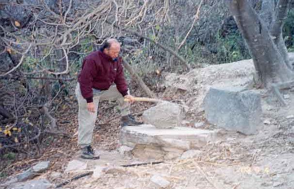
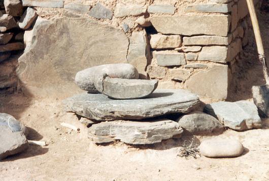
We saddled our animals and took a last foray through this particular mountain town. Near the cemetery and hidden under a large fig tree we found a mill built on a huge slab with a large stone as a "hand" with which to grind; to enable handling, the “hand” has a large wooden fork attached with wire. In this stone mill, the locals grind grain, especially the corn used to make flour for tasty corn cakes, but also to make the chicha, the only alcoholic beverage that circulates in the area. We noted that this is not the only mill; this is an instrument that is to be found in the courtyard of most of the houses. No doubt, time in these places has not elapsed, the customs still as ancestral as always.

10-Mill for grain in Higuera.


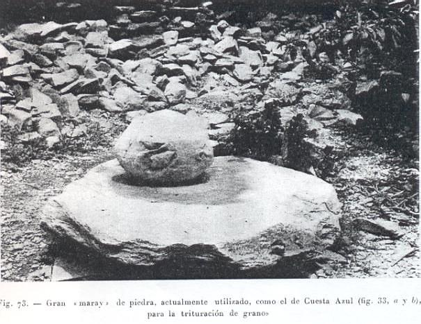
11-Old mill or Maray- (reproduction of Marquez Miranda's book-cited work).


12-Mill for grain in Higuera.


Stone mills

When Marquez Miranda in his book, cited previously, was in this place, he drew attention to these mills which they called "maray". It is curious that today nobody remembers this name.

Ing. Nicolás Bello


Continue on... Page 3

See Satellite Photo of this sector


Back to the Friends of VIAJEROS4x4 Menu


Back to the SALTA menu

Back to the VIAJEROS4x4 main menu